
Alpine Quest: Tactical GPS Pro for iOS
About Alpine Quest: Tactical GPS Pro
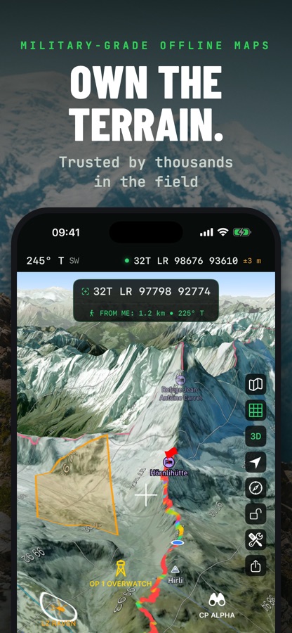
Tactical GPS is the Swiss Army knife of navigation — everything you need in one app. Plan routes, navigate cross-country, record tracks, analyze terrain and share your map with your team — online or fully offline, with the precision of a purpose-built instrument. Made for soldiers, SAR teams, hikers, hunters and anyone who reads maps. Designed and built natively for iPhone and iPad. No cross-platform compromises. Just a fast, precise tactical navigation experience.
OFFLINE NAVIGATION — NEW
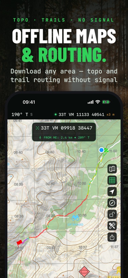
• Get routes with no signal: download routing data with your map regions (often just a few MB) — car, walking, hiking, cycling, MTB and river routes, calculated on your device
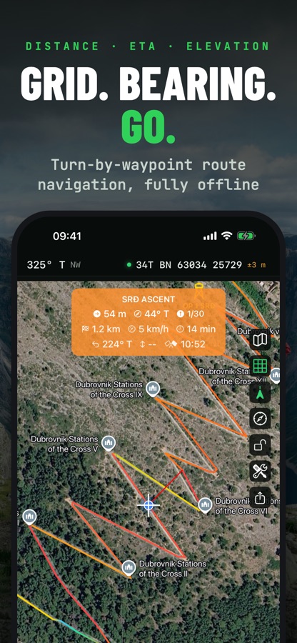
• Navigate to any pin along a real route — by car, on foot, hiking, trekking, MTB or by river
• Missed points are skipped automatically; Rejoin and Re-route bring you back on course
• Navigation continues with the screen locked — distance, bearing and ETA on your Lock Screen, alert on arrival
• Heading-up, course-up or north-up map rotation, with auto re-follow after you pan away
• Connection lost? Switch to your downloaded offline map in one tap
PLAN, NAVIGATE, TRACK
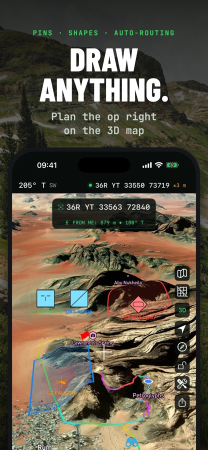
• Plan routes and areas directly on the map, online or offline
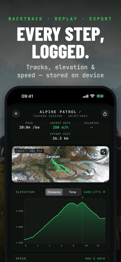
• Elevation profiles with slope colors, ascent/descent and estimated time
• Navigate point-to-point or along a route — live distance, bearing, ETA, back azimuth and elevation delta
• Record tracks with activities, laps, auto-pause and a Lock Screen Live Activity, then replay them on the map
• Set up geofences and proximity alerts on any pin
• Organize everything in layers, folders and tags — keep missions, trips and training areas separate
MAPS, ONLINE OR OFFLINE
• Download map regions, satellite imagery included, for fully offline use
• Add your own maps: WMS/WMTS, MBTiles, GeoTIFF, GeoPDF and AlpineQuest — stacked, with per-layer opacity
• 3D terrain view, live contour lines and hillshading
• MGRS, UTM, Lat/Lon or CK-42 grid overlay on every basemap
• Overlays for trails, cycling, ski slopes and sea marks
• Night-vision mode: red or green monochrome display across the entire app
FIELD & TERRAIN TOOLS
• Viewshed and line-of-sight analysis
• Range rings, radial ruler, bearings and point projections
• Distance and area measurement with per-segment labels
• NATO (APP-6) map symbols and custom pin icons
• Elevation and depth readings anywhere on the map
• On-position weather forecasts, sun and moon position
• Print maps to PDF at a chosen scale
PRECISION POSITIONING
• MGRS / UTM / USNG / Lat-Lon / CK-42 or any EPSG code, plus British, Irish, Swedish, Finnish, New Zealand, Indian and other national grids
• Dozens of map datums with proper transformations
• True, magnetic or grid north reference
• External Bluetooth GNSS receivers, with NTRIP corrections for RTK precision
• Import GPX, KML/KMZ, GeoJSON, GeoPackage, Shapefile, CSV, AlpineQuest and more
SHARE & SYNC
• Share a map layer with your team over iCloud: everyone sees pins, routes and shapes update live, attachments included. Invite-only, no accounts.
• Connect to a TAK server for real-time position, chat and data, with built-in certificate enrollment
• Export to GPX, KML/KMZ, GeoJSON, GeoPackage, CSV or DXF
• Back up everything into one file and restore it on any device
PERFECT FOR
• Land navigation and route planning
• Hiking, cycling and off-road exploration
• SAR and field operations
• Outdoor training and navigation exercises
Note: Route navigation, additional maps, unlimited overlays and layers, special tools, tracking, iCloud layer sharing and export features require a PRO upgrade.
Download Alpine Quest: Tactical GPS Pro for iOS for free — the latest version (3.17.5) is now available for installation on your iPhone or iPad.
What's New in the Latest Version 3.17.5
– Custom WMS/WMTS Maps – Add custom WMS and WMTS map layers to personalize your map experience and explore the data that matters most to you.
– Offline Directions – Download maps and directions for offline use and stay on track wherever your journey takes you. Whether you’re driving, walking, hiking or cycling, enjoy reliable navigation even without an internet connection.
– A Redesigned Maps Screen – Enjoy a reorganized Maps screen with an improved layout that makes it easier to access map options and manage your maps.
– Bug Fixes & UX Improvements – Benefit from bug fixes, performance enhancements and usability improvements for a smoother, more reliable and intuitive navigation experience.
Alpine Quest: Tactical GPS Pro App Info
- Version 3.17.5
- Updated November 7, 2026
- Requires OS iOS 16.0 and up
- Category Maps & Navigation
- Developer Ivan Blajic
- Age Rating 4+