
ForeFlight Mobile EFB for iOS
About ForeFlight Mobile EFB
Download for a 30-day free trial of our top subscription plan! Visit our website for more information on available plans and add-ons.
ForeFlight is the leading flight app for VFR and IFR pilots everywhere, making flight planning and flying easier, safer, and more enjoyable.
FLIGHT PLANNING, BRIEFING, & FILING
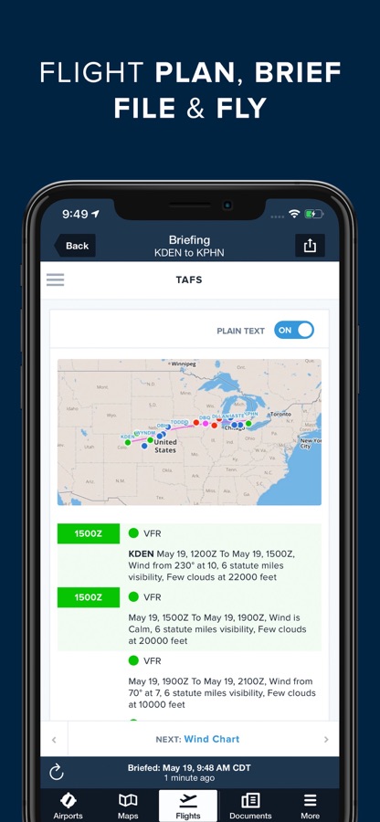
Plan flights with Touch Planning on the Map or full-featured form-based Flights view. Tap out a route in seconds and quickly see if flights will be affected by weather or TFRs. Helpful Route, Altitude, and Procedure Advisors make planning easy and accurate. Generate a graphical preflight briefing and file your flight plan directly from the app. Print a professional-grade Navlog for inflight reference.
WEATHER
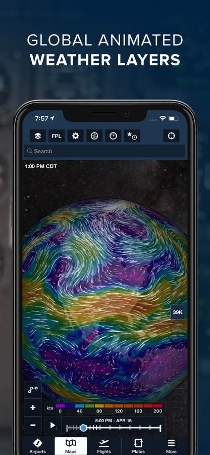
Interactive weather layers include animated radar, global satellite and winds aloft, global icing, turbulence, and surface analysis, graphical AIR/SIGMETs, flight category, visibility, and more. View decoded METARs, TAFs, and MOS forecasts. Thoughtfully organized Imagery view puts a full range of forecast tools at your fingertips.
PLATES, CHARTS, & MAPS
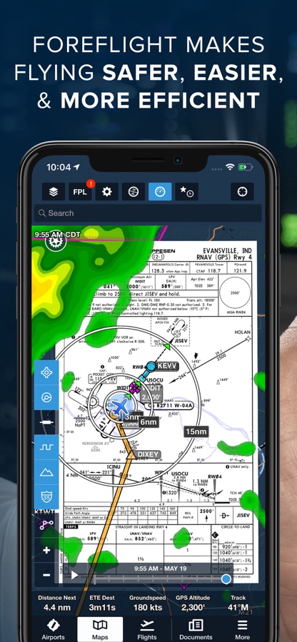
Both VFR and IFR operations are covered with all of the essentials required for planning and navigation: data-driven Aeronautical Maps, VFR Sectionals, High/Low Enroute charts, SIDs, STARs, approach and taxi charts, and terrain, satellite, and street map views.
GEO-REFERENCED APPROACHES & TAXI CHARTS
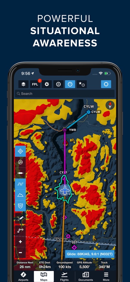
Plates and taxi charts enable the real time display of your GPS location on the chart. They can also be overlaid on the Maps view along with weather and hazards for the ultimate situational awareness.
GLOBAL HAZARD AWARENESS TECHNOLOGY
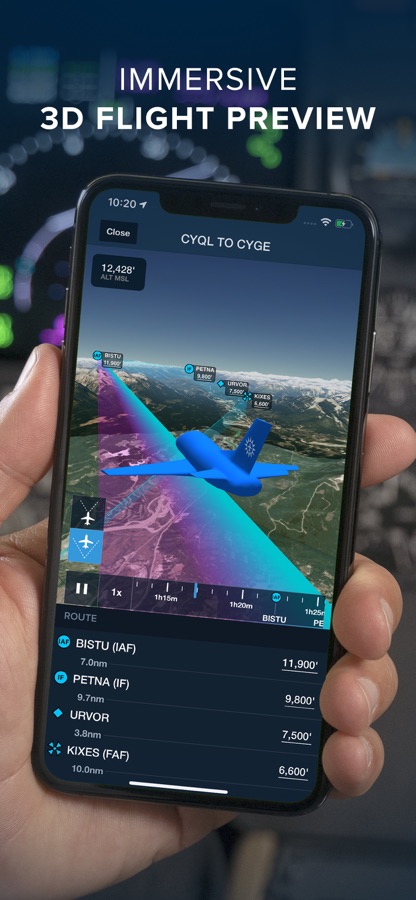
Plan and fly with more confidence in all conditions and terrain. Top-down-view Hazard Advisor map layer, Terrain Profile View, and 3D Synthetic Vision seamlessly integrate into the map display to depict a clear picture of terrain and obstacle hazards anywhere in the world. When paired with an AHRS source, Synthetic Vision provides a backup attitude display.
LOGBOOK
Logbook makes it easy to log and share flights, track hours, review currency, record certificates and ratings, receive electronic instructor endorsements, and create experience reports. Your data is automatically synced across all your devices and protected in secure cloud storage.
ADDITIONAL FEATURES INCLUDE:
Built-in documents catalog with FAR/AIM, charts supplements, and more
Airport, FBO, and fuel price information for thousands of locations
Dynamic data-driven Aeronautical Maps
Weight & Balance
Glide Advisor
Automatic chart and data data updates
Chart color inversion for better night flying experience
Access to web planner
Download ForeFlight Mobile EFB for iOS for free — the latest version (18.9.1) is now available for installation on your iPhone or iPad.
What's New in the Latest Version 18.9.1
Emergency Glide Mode: TrueGlide
• Get a more realistic picture of your glide range based on your actual glide performance and wind speeds during emergency scenarios.
• TrueGlide appears automatically in Emergency Glide Mode as a blue ring when ForeFlight detects a stable descent rate, alongside the existing green ring that calculates your glide range based on the glide ratio and best glide speed for the selected aircraft.
• You can disable TrueGlide using a new setting in the Map Settings menu which appears when Glide Advisor is enabled.
Enhanced Traffic Icons
• Change how traffic targets appear in ForeFlight based on their reported aircraft type.
• Enable the Enhanced Traffic Icons toggle in the Map Settings menu while connected to an ADS-B IN or FLARM receiver to replace the generic traffic icon arrow with more realistic icons representing commercial airlines, private jets, single-engine pistons, and other aircraft types, when this information is available.
• This setting is available with ForeFlight Essential subscription plans and above.
GPS Interference Map Layer
• See where GPS spoofing and interference have been reported recently so you can brief the risk and prepare without leaving ForeFlight.
• Enable the GPS Interference map layer from the right column of the Layer Selector just above the Traffic layer to display reports of GPS interference and spoofing directly on the map as yellow and red hexagons, respectively, and tap on these to see more information such as the age of the report and the affected altitudes.
• Available with Business Performance and MFB One subscription plans.
SMS Safety Event Reporting in ForeFlight Mobile
• Submit safety event reports right in ForeFlight Mobile. Select from several report types, work/submit offline, report anonymously, and get a suggested risk level based on the details entered. Receive email confirmations and updates.
• Available reports include general for standard safety reports, or a specialized report for Wildlife/Bird Strike, Fatigue, Airmiss/ATC Incident/TCAS RA, or Wake Turbulence events.
• Included in the SMS add-on for ForeFlight Business accounts. Contact sales@jepp.com to learn more.
Alternates on Active Navlog
• Keep your planned alternates and their filed routes on hand for the whole flight, so you can divert along the filed route after a missed approach or go direct from wherever you are.
• Alternate airports and their routes appear in gray within the Active Navlog map, and you can divert to an alternate from any waypoint or your present position using the Alternate Destinations option within any waypoint’s Actions menu.
• Available with the Active Navlog add-on for Business and Military accounts.
New in Dynamic Procedures
• The Dynamic Procedures sidebar now shows a runway’s published LDA or total length, as well as the airport’s transition altitude or level at the top of the route section.
• Dynamic Procedures is available with ForeFlight Essential plans and above in the US, Canada, and most of Europe.
MFB: Dynamic Corridor Widgets
• Monitor the time or distance remaining on each leg of a Low Level Corridor route with new enhanced panel widgets that act as dynamic progress indicators.
• Low Level Corridors are available with MFB One subscription plans.
MFB: Expanded DOD Obstacle Filtering
• The DOD Obstacles filter available in the Map Settings menu now applies to obstacles automatically shown while a Low Level Corridor is active, hiding any obstacles lower than the filter’s selected altitude to reduce map clutter.
• DOD Obstacles and Low Level Corridors are available with MFB One subscription plans.
ForeFlight Mobile EFB App Info
- Version 18.9.1
- Updated November 12, 2026
- Requires OS iOS 18.0 and up
- Category Weather
- Developer ForeFlight
- Age Rating 4+